
Anúncios
Colombia’s location along the Pacific Ring of Fire makes earthquake monitoring essential for millions of residents across the country.
Living in a seismically active region requires constant awareness and preparation. Colombia experiences hundreds of tremors annually, ranging from minor vibrations to potentially destructive events. Modern technology has transformed how citizens receive alerts and stay informed about seismic activity in real-time.
Anúncios
Smartphone applications have become indispensable tools for earthquake preparedness, offering instant notifications, historical data, and safety resources. These digital solutions bridge the gap between scientific institutions and everyday citizens, democratizing access to critical information that can save lives.
🌎 Understanding Colombia’s Seismic Landscape
Colombia sits at a complex geological crossroads where three tectonic plates converge: the Nazca, South American, and Caribbean plates. This intersection creates significant seismic pressure, making the country one of South America’s most earthquake-prone nations.
Anúncios
The Pacific coastal regions, including departments like Chocó, Valle del Cauca, and Nariño, face the highest risk. Major cities such as Bogotá, Cali, Medellín, and Bucaramanga all lie within zones of varying seismic hazard levels. The Colombian Geological Service (SGC) records approximately 2,500 seismic events annually, though most remain imperceptible to humans.
Historical events demonstrate the real danger. The 1999 Armenia earthquake killed over 1,000 people and destroyed 60% of the city’s infrastructure. The 1994 Páez earthquake triggered deadly landslides, claiming more than 1,000 lives. These tragic reminders underscore why preparedness isn’t optional—it’s essential.


Why Traditional Warning Systems Need Digital Support
Government institutions like the SGC provide excellent monitoring through their network of seismographs and official channels. However, traditional warning methods face limitations in our fast-paced digital age.
Radio and television alerts may not reach people who are mobile, at work, or engaged in activities without media access. Official websites require active checking rather than providing automatic notifications. SMS systems can experience delays during network congestion following major events.
Mobile applications fill these critical gaps by delivering instant, location-specific alerts directly to your pocket, regardless of what you’re doing.
📱 Key Features to Look for in Earthquake Detection Apps
Not all seismic monitoring applications offer the same capabilities. Understanding which features matter most helps you choose the right tool for your safety needs.
Real-Time Alert Systems
The most critical feature is push notification capability. Quality apps send alerts within seconds of seismic detection, giving you precious time to react. Customizable notification settings let you filter by magnitude—you might want alerts for all events above 4.0 magnitude, for example, while ignoring minor tremors.
Location-based filtering ensures you receive relevant information. An earthquake in Pasto shouldn’t trigger panic notifications for someone in Barranquilla, though the information might still be accessible for those with family or business interests in affected areas.
Comprehensive Data Visualization
Visual mapping tools transform raw seismic data into understandable information. Interactive maps showing epicenter locations, depth measurements, and affected radius help you assess personal risk quickly.
Historical data access allows pattern recognition. Reviewing seismic activity over weeks or months reveals clustering patterns that might indicate increased risk in specific zones.
Educational Resources and Safety Protocols
Beyond detection, the best apps include preparedness guides covering:
- Drop, Cover, and Hold On techniques
- Emergency kit checklists tailored to Colombian contexts
- Family communication plans for post-disaster scenarios
- Building safety assessments after tremors
- Tsunami risk information for coastal residents
Multiple Data Source Integration
Top-tier applications aggregate information from multiple seismological networks, including USGS (United States Geological Survey), EMSC (European-Mediterranean Seismological Centre), and Colombia’s SGC. This redundancy ensures reliability even if one network experiences technical issues.
🔔 How Earthquake Alert Apps Actually Work
Understanding the technology behind these applications helps set realistic expectations about their capabilities and limitations.
The Detection Process
Seismographic stations detect ground motion through sensitive instruments that measure earth movement in three dimensions. When sufficient stations register coordinated activity, automated systems calculate the event’s magnitude, depth, and epicenter location.
This data feeds into global and regional databases through standardized protocols. Quality smartphone applications connect to these databases via APIs (Application Programming Interfaces), pulling fresh data at regular intervals—typically every few seconds to minutes.
When new seismic events meet your configured criteria (location proximity, minimum magnitude), the app’s notification system activates, sending a push alert to your device even if the app isn’t actively open.
The Speed Factor
Seismic waves travel at approximately 3-5 kilometers per second. Electronic signals transmit essentially instantaneously. This speed difference creates a crucial warning window for people farther from the epicenter.
If an earthquake strikes 100 kilometers away, seismic waves need 20-33 seconds to reach you. A properly configured app might alert you within 5-10 seconds of initial detection, providing 10-25 seconds of advance warning—enough time to take protective action.
However, for people very close to the epicenter, no technological system can provide advance warning because the shaking arrives before detection systems can process and transmit information.
🛡️ Maximizing Your Safety with Detection Apps
Simply downloading an application doesn’t guarantee safety. Proper configuration and understanding turn these tools into effective protective measures.
Optimal Configuration Settings
Set your proximity radius to cover areas you care about. A 200-kilometer radius around your primary location captures events that might affect you while filtering distant tremors.
Adjust magnitude thresholds thoughtfully. Setting alerts for events above 3.5-4.0 magnitude provides meaningful warnings without notification fatigue from constant minor tremors.
Enable location services for automatic position updates, particularly important for frequent travelers moving between regions with different risk profiles.
Testing and Familiarity
Don’t wait for an actual emergency to learn how your app works. Explore all features during calm periods:
- Review historical events in your area
- Test notification sounds and vibration patterns
- Practice navigating to safety information quickly
- Verify that alerts function when your phone is locked or in sleep mode
Familiarity breeds confidence. When genuine alerts arrive during stressful moments, muscle memory from previous exploration helps you respond effectively rather than fumbling with unfamiliar interfaces.
Integration with Broader Preparedness Plans
Technology complements—but never replaces—comprehensive preparation. Your detection app should integrate into a larger safety framework:
Physical preparedness includes securing heavy furniture, maintaining emergency supplies, and identifying safe zones in your home and workplace.
Communication protocols establish how family members will reconnect if separated during an event, considering that cellular networks may be overwhelmed or damaged.
Regular drills transform knowledge into automatic responses. Practicing drop-cover-hold techniques ensures your body reacts correctly even when your mind is shocked.
📊 Comparing Popular Earthquake Detection Applications
Several applications serve Colombian users effectively, each with distinct strengths and approaches.
| Feature | My Earthquake Alerts | Earthquake Network | LastQuake |
|---|---|---|---|
| Data Sources | USGS, EMSC, multiple networks | Crowd-sourced + official | EMSC official |
| Alert Speed | 30-90 seconds | 10-30 seconds (proximity) | 1-2 minutes |
| Customization | Extensive filters | Moderate options | Basic settings |
| Offline Access | Historical data only | Limited functionality | Safety guides available |
| Cost | Free with ads/premium option | Free | Completely free |
My Earthquake Alerts: Comprehensive Monitoring
This application excels at customization and data aggregation. Users configure multiple monitoring circles—one around home, another near workplace, perhaps a third near elderly parents’ residence.
The interface displays magnitude, depth, distance, and time clearly. Color-coded markers help quickly assess severity. Premium versions remove advertisements and add features like detailed statistical analysis.
Earthquake Network: Community-Powered Detection
This innovative app uses smartphone accelerometers as a distributed detection network. When multiple devices in proximity detect vibrations simultaneously, the system can identify earthquakes before official networks process the data.
For densely populated Colombian cities, this crowd-sourced approach potentially shaves precious seconds off warning times. However, effectiveness depends on user density—rural areas see less benefit.
LastQuake: EMSC’s Official Tool
Developed by the European-Mediterranean Seismological Centre, LastQuake prioritizes reliability over speed. Alerts arrive after thorough verification, reducing false positives but adding slight delays.
The app’s strength lies in felt reports—user-submitted testimonials that provide ground-truth information about shaking intensity in specific neighborhoods, supplementing instrumental measurements.
🌐 Integrating Official Colombian Resources
International applications provide excellent coverage, but Colombia’s Servicio Geológico Colombiano offers specialized local resources worth incorporating into your safety strategy.
SGC’s Official Channels
The SGC website (sgc.gov.co) publishes real-time seismic data for Colombia with context about local geological conditions. Their Twitter account (@sgcol) provides rapid updates in Spanish, directly relevant to Colombian residents.
The institution’s educational materials explain regional fault systems, helping citizens understand why certain areas experience more frequent activity. This knowledge transforms abstract numbers into meaningful risk assessments.
Municipal and Departmental Systems
Major cities operate their own emergency management systems. Bogotá’s IDIGER, Medellín’s DAGRD, and similar agencies in other municipalities offer localized alerts and preparedness programs.
Combining app-based notifications with official municipal channels creates redundant information streams, ensuring you receive critical updates through multiple pathways.
🧠 Understanding Alert Types and Response Protocols
Different seismic events require different responses. Interpreting alert information correctly ensures appropriate action.
Minor Events (Magnitude Below 4.0)
These tremors rarely cause damage but serve as important reminders. Use them as prompts to review your preparedness checklist and ensure emergency kits remain stocked and accessible.
Moderate Events (Magnitude 4.0-5.9)
Potentially damaging, especially in older buildings or poorly constructed structures. If you feel shaking:
- Immediately drop, cover, and hold on
- Stay away from windows and heavy objects
- Remain in protected position until shaking stops
- Exit buildings carefully, watching for structural damage
- Stay outside, away from building facades that might shed debris
Major Events (Magnitude 6.0+)
Serious earthquakes requiring full emergency protocols. Beyond immediate protective actions, prepare for:
Aftershocks—secondary tremors that can cause additional damage to already-weakened structures. Expect multiple aftershocks over hours or days.
Infrastructure disruption—loss of electricity, water, and communications requires pre-positioned supplies and alternative contact methods.
Evacuation scenarios—know designated assembly points in your community and routes to reach them safely.
💡 Advanced Features for Power Users
Beyond basic notifications, sophisticated users can leverage advanced capabilities for enhanced awareness.
Seismic Pattern Analysis
Some applications provide statistical tools showing temporal patterns—time-of-day distributions, monthly trends, or magnitude frequency charts. Geologists use these patterns to identify anomalous activity that might precede larger events.
While no reliable earthquake prediction method exists, recognizing when activity deviates from normal patterns encourages heightened vigilance and preparedness verification.
Cross-Platform Synchronization
Configure the same app on multiple devices—personal phone, work tablet, family members’ devices—creating a distributed alert network. If one device is silenced or misplaced, others provide backup notification.
Integration with Smart Home Systems
Advanced users integrate earthquake apps with smart home platforms. When alerts trigger, automated systems can shut off gas valves, unlock doors for rapid exit, or activate backup lighting—all within seconds of detection.
🔍 Common Misconceptions About Earthquake Apps
Understanding what these applications cannot do is as important as knowing their capabilities.
They Don’t Predict Earthquakes
No technology can forecast when earthquakes will occur. Apps report seismic events after detection, not before occurrence. Claims of predictive capability indicate pseudoscience rather than legitimate seismology.
Alerts Aren’t Instantaneous
Even the fastest systems require seconds to detect, process, and transmit information. People very near the epicenter will feel shaking before receiving notifications—this represents physics, not technological failure.
False Positives Can Occur
Sensitive detection systems occasionally register non-seismic events like large explosions, heavy construction, or instrument malfunctions. Crowdsourced apps may generate alerts from coordinated human activity rather than earthquakes.
Credible applications quickly issue corrections when false positives are identified. Checking multiple sources before taking dramatic action helps filter spurious alerts.
🚀 The Future of Seismic Monitoring Technology
Earthquake detection continues evolving rapidly, with emerging technologies promising enhanced capabilities.
Machine Learning and AI Integration
Artificial intelligence systems analyze massive seismic datasets, identifying subtle patterns invisible to traditional analysis. These systems may eventually provide probabilistic forecasts—not definite predictions, but statistical assessments of increased risk periods.
Expanded Sensor Networks
Initiatives like the MyShake project transform millions of smartphones into distributed seismographs. As participation grows, detection accuracy and speed improve, particularly in regions with sparse traditional monitoring infrastructure.

Integrated Multi-Hazard Platforms
Future applications will likely combine earthquake monitoring with other hazards—volcanic activity, landslides, floods, and severe weather—creating comprehensive risk awareness tools rather than single-purpose applications.
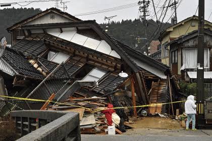
📱 Taking Action Today
Colombia’s geological reality requires preparation, not panic. Modern detection applications provide accessible, effective tools for staying informed and responding appropriately to seismic threats.
Download a reputable earthquake monitoring app today. Spend fifteen minutes configuring settings appropriately for your location and risk tolerance. Review safety procedures with family members, and establish communication protocols for emergency scenarios.
Technology empowers preparedness, but human action determines outcomes. These digital tools are most effective when combined with physical preparation, knowledge, and practiced response protocols. Your smartphone can deliver critical alerts, but only you can take the protective actions that safeguard yourself and loved ones.
The next significant seismic event is not a matter of “if” but “when.” The preparation you complete today—including installing and configuring detection apps—directly impacts your safety when that inevitable moment arrives. Colombia’s seismic challenges are real, but with proper tools and preparation, residents can face them with confidence rather than fear.
